
Web Sentinel
Web-based Flight-Following,
Messaging, Data Reporting
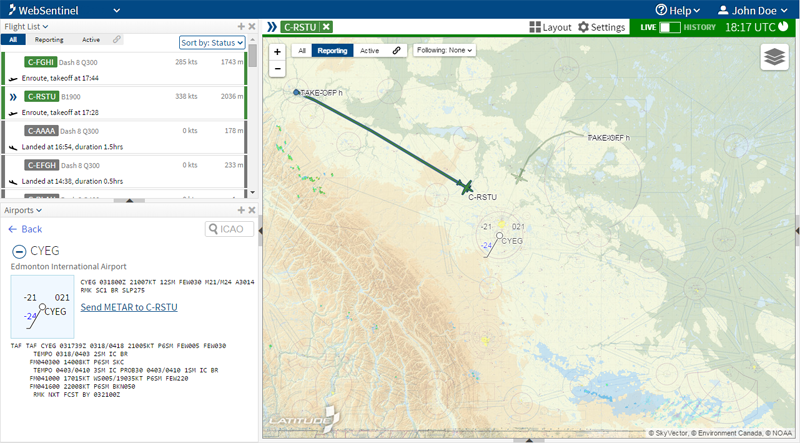
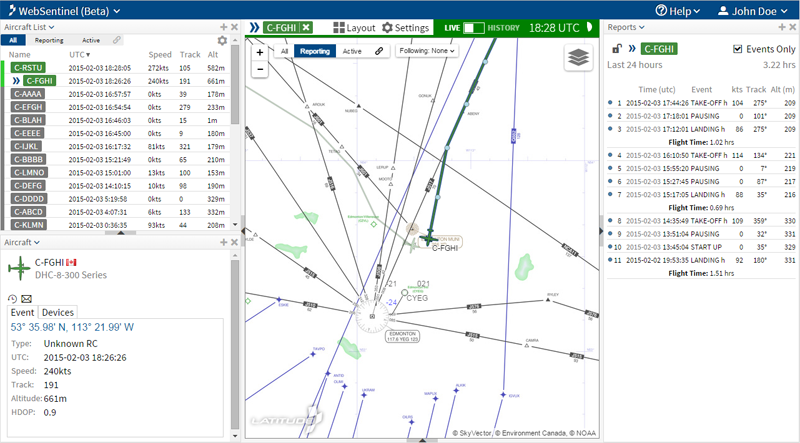
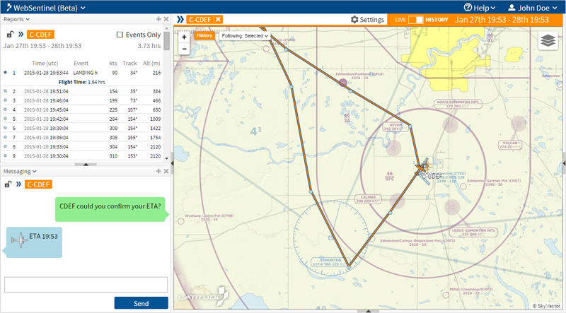
Display both live and historic flight data from your SkyNodeR equipped fleet using any map type and data table. Receive email alerts of events such as take-offs and landings, including customized flight profiles. Remotely control the operating parameters of each SkyNodeR satcom transceiver. Add as many viewers, such as clients and employees, as you like.
Accessible Anywhere, Anytime
Latitude Web Sentinel subscription-based data management service offers a reliable and affordable solution for processing geo-positioning and telematics data, collected and distributed by SkyNode and GeoNode devices operating on-board aircraft, overland vehicles and marine craft.
Benefits
- Better manage aircraft location and operational status
- Better protect operator and asset with event-triggered or automated alerts
- Improve fi eld operator effi ciency
- Improve maintenance coordination
- Track mission ETE, and collect mission time and distance usage
- Download the data into your business reporting/invoice programs
- Supports concurrent web-users
- Exceeds US Forestry AFF.GOV reporting requirements
- Integration to your proprietary ERP system
- Secure data transfer
Features
- Display real-time and historic fl ight paths
- 2-way messaging
- Event-triggered or automated alerts
- Modify device reporting characteristics from desktop
- Administer custom access logins for your clients and employees
- Take-off, landing, ETE and distance usage for mission statistics reports
- Position, heading, speed, altitude and other fl ight status data
- Real-time Google Earth/Maps coverage
- Distance calculation
- Custom map location markers
- Interface to 3rd party applications
- GEO-fencing
- Subscriptions starting at $10 month
- Secure enterprise grade solutions
Web Sentinel supports